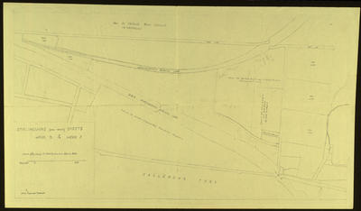
Plan of Feu Plan, Bog Road, Laurieston

Maker
Forbes of Callendar
Production date
(Mid 20th Century) {nd}
Description
Feu plan of area at Bog Rd, Laurieston
See full details

Object detail

Department
Record level
Item
Production date
(Mid 20th Century) {nd}
Secondary production date
(Mid 20th Century)
Measurements
50cm x 29cm
Restriction
Off-site storage
Accession number
A1085.076

Share

My shortlist

Explore other objects by colour

Group record

Public comments

Be the first to comment on this object record.

Google reCaptchaThis site is protected by reCAPTCHA and the Google Privacy Policy and Terms of Service apply.