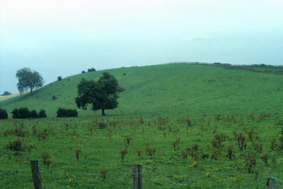
Drumlin at Avonbank, Bo'ness
Maker
Thomas McInnes
Production date
1978
Description
View of a grass covered rounded hill about 25 metres high. It is a drumlin. The plants growing on the ground below it suggest poor drainage.
See full details
Object detail
Where boulder clay is thickly plastered over a rock floor of low but probably irregular relief, it has been moulded by the former ice-sheets into swarms of whale-shaped mounds called drumlins (from the Gaelic, druim, a mound). The steeper slope faces into the direction of ice flow.


Public comments
Be the first to comment on this object record.